
The ‘Nazca Lines’ describe a series of geoglyphs spread across the Nazca Desert in Peru. Although an exact date of the creation of these geoglyphs cannot be pinned, we estimate the majority of them to have been made between 500BCE and 500CE. Interestingly enough, the lines themselves were mistaken for vestiges of roads and paths in the past, as their sheer magnitude makes their shapes indistinguishable when observed from the ground. It’s when humans began mastering flight and gaining some altitude that we managed to realize these ‘roads’ were in fact massive geometric shapes, made through shallow trenches in the dirt reinforced with larger rocks.
Nazca has become increasingly interesting as the technology available to us continues to evolve. With airplanes and drones we are able to take a look at the geoglyphs from above and behold their true shape and size. What’s more, the creation of digital mapping software has been very important in our quest to understanding the Nazca lines. GIS allows us to meticulously measure the Nazca lines according to different parameters, as well as allowing us to join the data with any finds in the region.
One of my last exercises during a GIS course in my second year of archaeology was to plot viewsheds of the Nazca lines in QGIS. In short, this meant that we were given the spatial data of the geoglyphs, and we were tasked with finding the natural vantage point from which most of the geoglyphs were visible. What fascinated me the most about this exercise is how hard it is to access these natural vantage points, and how easy it was to miss geoglyphs if you’re standing just a little too close to them. Viewsheds are just another example of how important GIS is to the field of archaeology, even moreso when you can apply other data such as the position of celestial bodies, or even shadows made on certain days (ie. solstices).
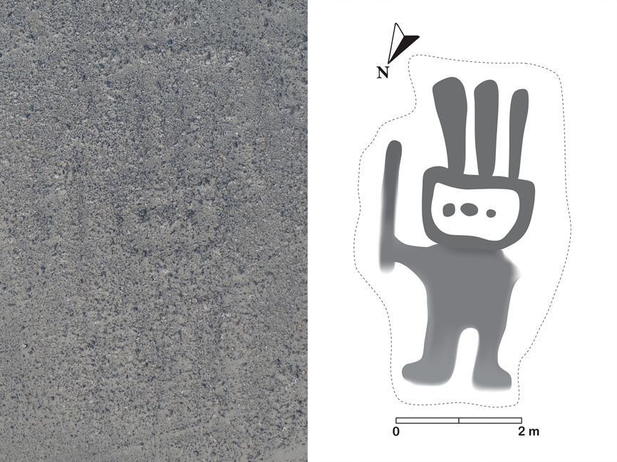
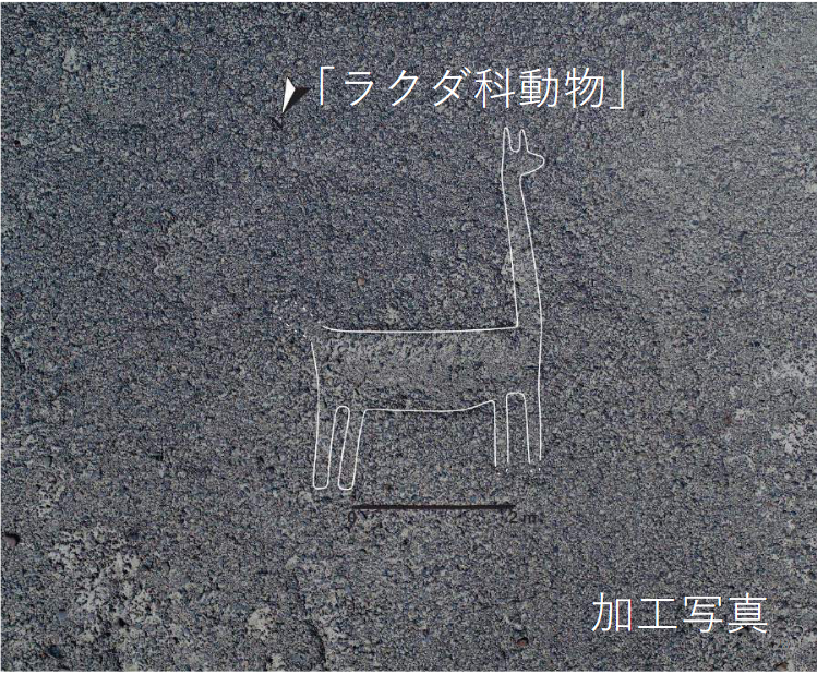
Even more interesting is the possibility of combining AI with archaeological surveying, as was done by Yamagata University and IBM in 2019. This project worked by using an AI to analyze sets of high-resolution 3D data and aerial photos of the sites. The results yielded by the project were nothing short of amazing, with 143 new geoglyphs being discovered thanks to IBM’s AI and professor Masato Sakai’s research. Masato Sakai’s research sought to protect the UNESCO heritage site of Nasca Pampa, although the main hurdle in cataloguing the site was the actual surveying– there’s simply too much to be done manually and by human researchers.
What’s important to note about this project is it extends beyond Nasca Pampa, and across the whole world. AI detection of sites is an extremely valuable resource in archaeology due to its great efficiency. Not to mention the fact that automated detection means that archaeologists don’t have to be present on-site for surveying, allowing researchers to survey from a safe distance is the site itself cannot be reached (think warzones or simply how uncomfortable it is to drag a bunch of tired archaeologists through the desert in the summer). Other researchers have already undertaken similar projects, coding AI able to detect specific types of sites such as burial mounds, for example. Or maybe, just maybe, we could apply such knowledge to projects closer to home?
Sources
- https://www.yamagata-u.ac.jp/en/information/info/20191115_01/
- https://www.yamagata-u.ac.jp/en/download_file/view/1273/550/
- https://www.lonelyplanet.com/peru/south-coast/nazca/attractions/nazca-lines/a/poi-sig/465868/363428
- www.contemporarynomad.com/wp-content/gallery/nazca/

Recent Comments